Track Hurricanes and Tropical Storms in Google Earth
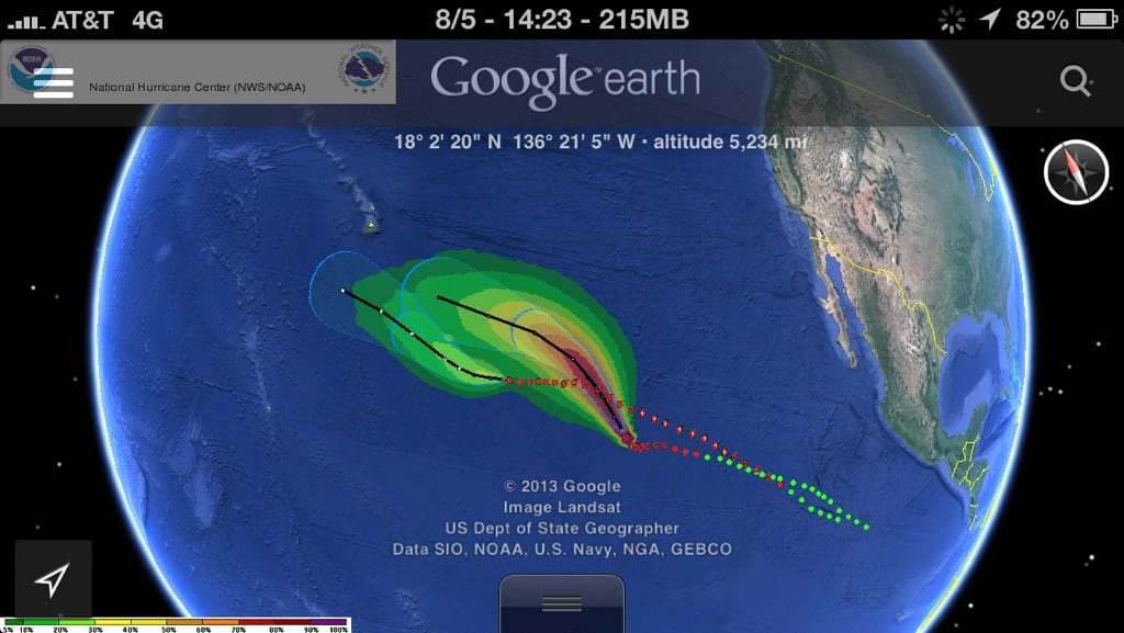
Storm Tracking with Google Earth iPhone, iPad or Computer users access storm data using the Google Earth application.
Click on Google Earth image to download file from dropbox.com open using Google Earth to visualize storm in real-time. Must have Google Earth installed first.
This is an experimental service
The National Weather Service produces several data sets that are available in formats available to import into Geographic Information Systems (GIS). GIS is a collection of computer hardware, software, and geographic data for capturing, managing, analyzing, and displaying all forms of geographically referenced information. It takes the numbers and words from the rows and columns in databases and spreadsheets and puts them on a map
The following links will either provide kml/kmz files, will link you to a page with these type of files, or displays info in a GIS viewer.
ESRI’s ArcGIS Explorer – KML file format support – free download from ESRI.com
GoogleEarth viewer – KML file format support – free download from Google.com
RIDGE Image and Warning Output to KML/KMZ
While the RIDGE radar display allows for the use of interactive toggles with the image, RIDGE images can be best utilized with GIS software.
Visit the NWS website Standards Description Website which explains KML in more detail. With the kmz files here
you can display any of the the National Weather Service RIDGE radar images including polygons. Choose your overlay from any of the following possibilities…
- a single NWS radar image
- by individual radar
- by a statewide composite
- multiple images by individual radar, or
- choose any combination of radars and images.
- Real-time NWS polygon warnings
KML 2.1 and some earth viewing applications support animation of image overlays.


