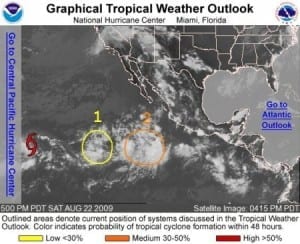
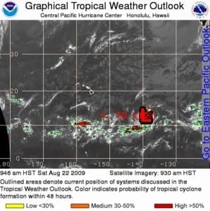
000 Wtpz31 Knhc 222033 Tcpep1 Bulletin Tropical Storm Hilda Advisory Number 2 Nws Tpc/national Hurricane Center Miami Fl Ep112009 200 Pm Pdt Sat Aug 22 2009
…new Tropical Storm Forms In The Far Western Portion Of The Eastern Pacific Basin…
At 200 Pm Pdt…2100 Utc…the Center Of Tropical Storm Hilda Was Located Near Latitude 13.6 North…longitude 137.7 West Or About 1930 Miles…3105 Km…west-southwest Of The Southern Tip Of Baja California And About 1225 Miles…1970 Km…east-southeast Of Hilo Hawaii.
Hilda Is Moving Toward The West Near 10 Mph…17 Km/hr…and This Motion Is Expected To Continue For The Next 24 To 48 Hours.
Maximum Sustained Winds Have Increased To Near 40 Mph…65 Km/hr…with Higher Gusts. Little Change In Strength Is Expected During The Next Day Or Two.
Tropical Storm Force Winds Extend Outward Up To 35 Miles…55 Km From The Center.
Estimated Minimum Central Pressure Is 1006 Mb…29.71 Inches.
…summary Of 200 Pm Pdt Information… Location…13.6n 137.7w Maximum Sustained Winds…40 Mph Present Movement…west Or 275 Degrees At 10 Mph Minimum Central Pressure…1006 Mb
The Next Advisory Will Be Issued By The National Hurricane Center At 800 Pm Pdt.
$$ Forecaster Kimberlain/brennan


Leave a Reply