Data Source: https://inciweb.nwcg.gov/incident/5927/
California, Sierra National Forest
Incident Type: Wildfire
Updated: 7/26/2018, 2:59:07 AM PST
Size: 43,299 Acres
Contained: 27%
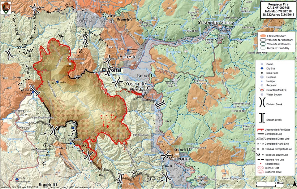
Ferguson Fire Morning Update for July 26, 2018
Ferguson Fire Wildfire
News – 5 hrs. ago
Engines: 241 Water Tenders: 47 Helicopters: 18 Crews: 94 Dozers: 63 Total Personnel: 3,686
Firefighters worked through the night to expand and strengthen containment lines around the Ferguson Fire. The fire grew by 1,723 acres overnight to a total of 43,299 acres as of 6 a.m. Containment is at 27 percent.
Firefighters and bulldozers worked through the night improving and expanding containment lines, particularly near Magoon Creek, to isolate the spread of a fire that had slopped over an existing containment line the previous morning along the fire’s southern perimeter.
Along the north edge of the fire, bulldozers and firefighters completed a containment line from the Five Corners area to Pilot Peak. Meanwhile crews worked to dig a containment line from the boundary of the Stanislaus National Forest to the fire’s perimeter.
Crews were successful in completing containment lines around the community of Wanona along the fire’s east side. Firing operations expanded the width of the containment line protecting the community of El Portal to more than 500 feet in some areas.
While some residents were allowed to return to their homes in portions of Jerseydale and Mariposa Pines southwest of the fire, crews continued patrolling structures and monitoring containment lines within areas still under evacuation.
Yosemite National Park closure: Yosemite National Park officials enacted closures today for the Yosemite Valley and Wawona areas, as well as the Mariposa Grove of Giant Sequoias. For information on Yosemite National Park, go to: nps.gov/yose or call 209-372-0200.
Incident Contacts
Ferguson Fire Information
Email: FERGUSONSNF@gmail.com
Phone: 530-377-6221
Hours: S-S 8AM – 9PM
Ferguson Fire Media
Phone: 530-377-6424
Incident Information
Basic Information
| Current as of | 7/26/2018, 2:59:07 AM |
| Incident Type | Wildfire |
| Cause | Unknown |
| Date of Origin | Friday July 13th, 2018 approx. 08:30 PM |
| Location | Highway 140 and Savages Trading Post |
| Incident Commander | Jay Kurth, California Interagency Incident Management Team 4(CIIMT4) |
| Coordinates | 37.652 latitude, -119.881 longitude |
Current Situation
| Total Personnel | 3,686 |
| Size | 43,299 Acres |
| Percent of Perimeter Contained | 27% |
| Fuels Involved | Brush and timber, burning in steep inaccessible terrain. |
| Significant Events | Hwy 140 is closed from 1.9 miles east of Midpines to the Cedar Lodge area MOTORISTS ARE ADVISED TO USE AN ALTERNATE ROUTE |


Leave a Reply